Hiking heatmap poster
Every trail you’ve hiked, on one wall map.
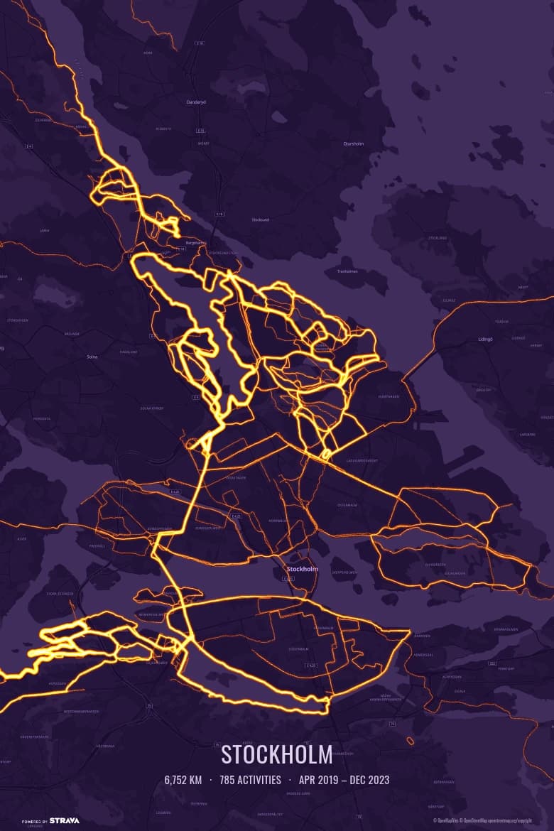
Your hikes are scattered across weekends and watch syncs. Heatmapster draws them together from your own Strava activities as a 300 DPI print: every trail you’ve walked on one map, glowing brightest on the paths you keep coming back to.
 Free — 3 posters per account.
How to make your hiking heatmap poster
- Connect Strava. Read-only access; your activities start importing straight away.
- Choose what goes on the map. Hikes only, hikes and trail runs, one year, or a hand-picked set.
- Frame it. Drag and zoom to your mountains, coast or national park, pick a colour theme and add an optional caption, like a trip name or a year.
- Download and print. A 12×18 inch (30.5×45.7 cm) PDF at 300 DPI, ready for any print shop or online print service.
One honest limit: the hikes have to be on Strava (there is no GPX upload), and the map only ever shows your own routes, never anyone else’s.
A screenshot, or a map you can frame?
A phone screenshot of a hiking app is a few thousand pixels wide and has buttons and labels in it. A poster needs the map redrawn at print resolution, with thin trail lines kept sharp and the area you chose filling the frame.
That is the one job Heatmapster does: take the hikes you already recorded and turn them into a file a print shop can use. A good gift to yourself after a big season, too.
Questions
How do I make a poster of all my hikes?
Connect Strava, filter to Hike (and Walk, if you like), pick the years you want and frame the map on your favourite mountains, coast or national park. Heatmapster draws every recorded hike on one map at 300 DPI and gives you a 12×18 inch PDF to print. It is free — 3 posters per Strava account, with no payment step.
Which hikes end up on the map?
The hikes recorded to your own Strava account, either with the Strava app or synced automatically from a Garmin, Coros, Suunto, Wahoo or Apple Watch. You can tick or untick single hikes, so a one-off drive-to-the-trailhead detour doesn't have to stay.
Can I include multi-day treks and thru-hikes?
Yes, as long as they are recorded as activities on Strava. Zoom out to fit a whole long-distance trail on the poster, or zoom in on one valley that you keep coming back to.
Can I mix hikes with runs, rides or ski tours?
Yes. The sport filter is yours: hikes only, hikes plus trail runs, or everything you've ever recorded. Pick one colour theme for the lot.
Is it a trail map with other people's routes?
No. The poster only contains your own activities, drawn on a clean base map of the area. It is not a trail-network or popularity map.
Can I upload a GPX file instead of connecting Strava?
Not at the moment. Heatmapster reads your activities from Strava, so a hike has to be on Strava first, which most watches and tracking apps can sync to automatically.
What size is the file?
A 12×18 inch (30.5×45.7 cm) PDF at 300 DPI in portrait or landscape. The 2:3 shape fits standard 20×30, 30×45 and 40×60 cm and 8×12, 12×18 and 16×24 inch frames. You print it wherever you like; nothing is shipped.
See your hikes on one map
Connect Strava and your hikes start importing straight away.